Wind
9.2knstable
FishSignal
Set the wind, waves, time window and Bite Index that work for you. FishSignal compares them by location, alerts you when they match and helps you decide what to target.
YOUR LOCATION · YOUR RULES · ONE SIGNAL
Selected locationOne place, one planning context
Weather & sea signalWind · waves · pressure
Conditions IndexCalculated reference for selected water
02 · WEATHER IS ONLY ONE LAYER
FishSignal combines sea conditions, weather and selected-water context to provide a calculated planning reference for your trip window.
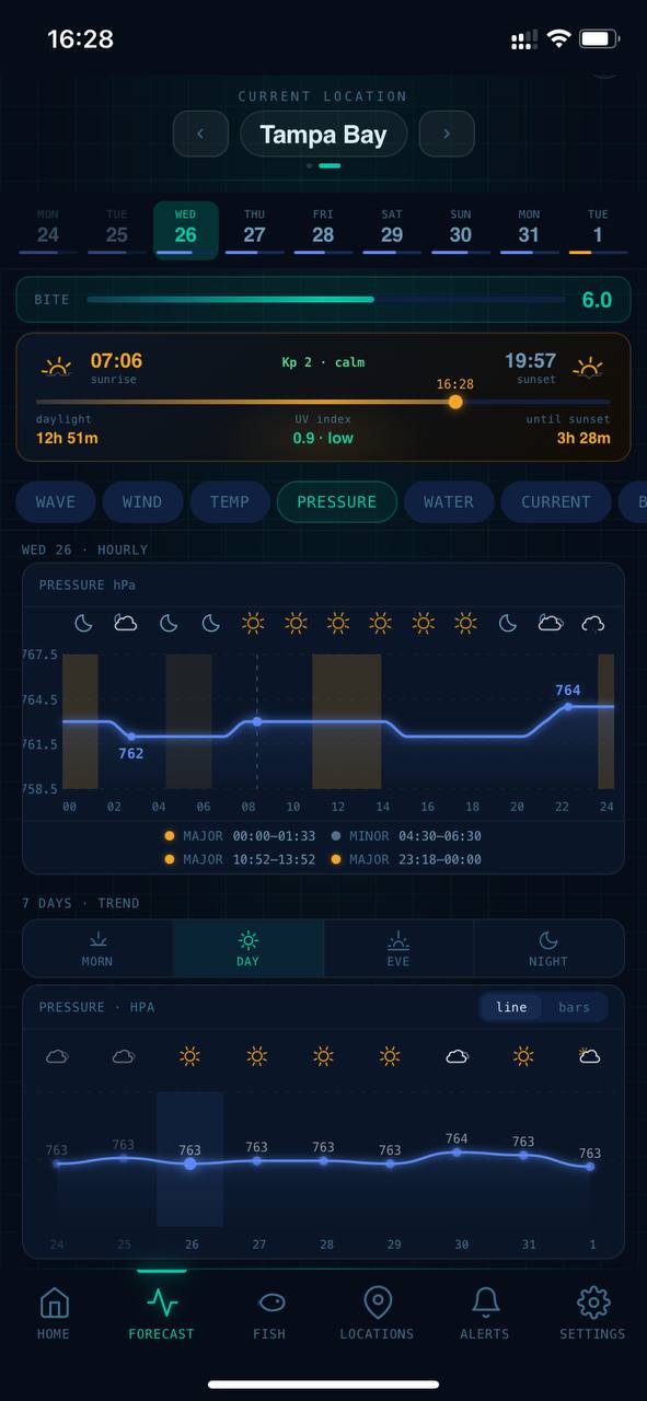
Pick the hour, not just the day.
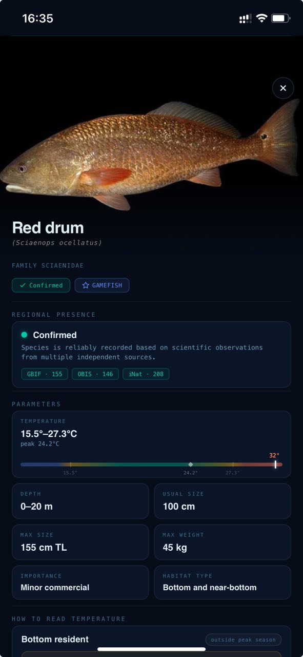
See which species fit the location and season.
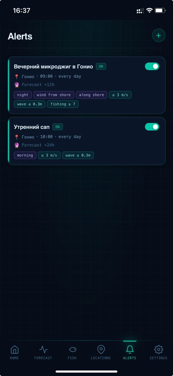
Get alerted when your conditions match.
02 · PLAN THE TRIP. NOT JUST THE WEATHER.
Find a fishing window, choose species that fit the location, and get alerted when your conditions line up.
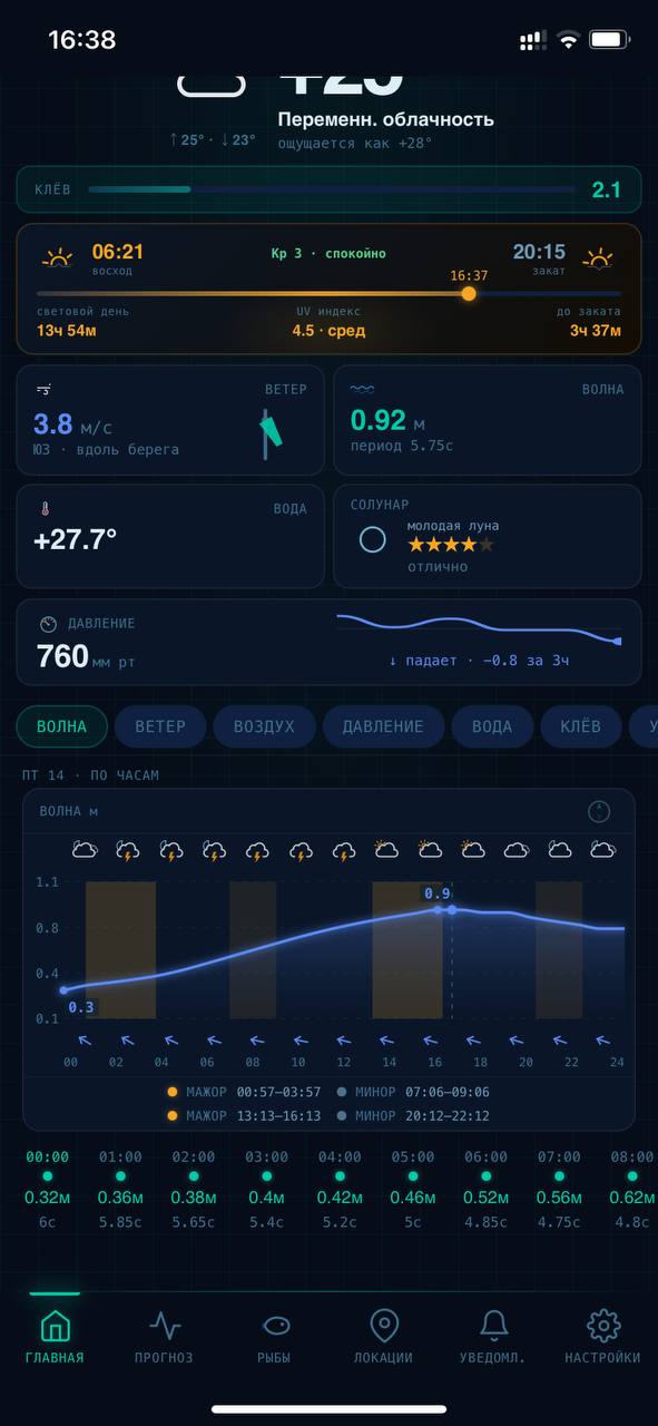
04 · ONE VIEW FOR THE DECISION
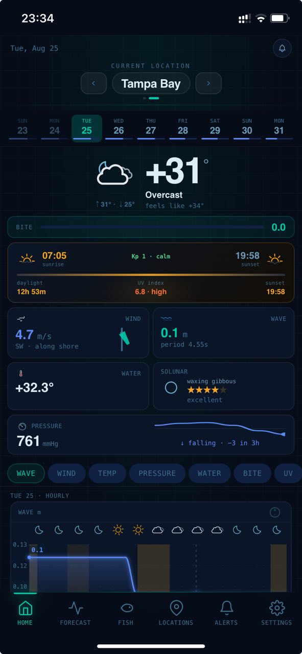
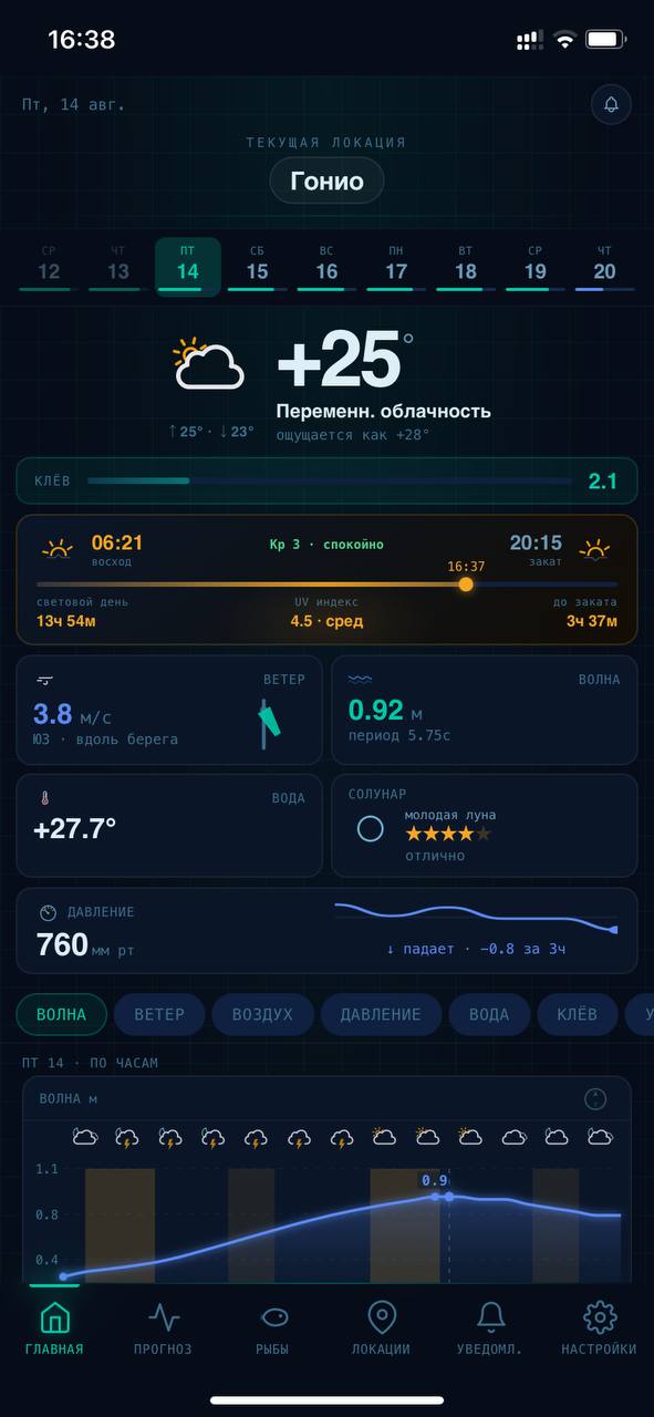
Start with the big picture: current conditions, changing signals, solunar context and a weather-based Bite Index for the selected location.
03 · FORECAST EXPLORE
See how waves, wind and pressure change hour by hour—and find the time window that fits your rules.
04 · BITE INDEX
FishSignal combines wind, waves, pressure, water temperature and time context into a 0–10 Bite Index—making hours and locations easier to compare.
A PLANNING REFERENCE · NOT A CATCH PREDICTION
BITE INDEX
05 · SPECIES INTELLIGENCE
FishSignal combines documented regional presence with season, depth, water temperature and daily activity context to help you choose a relevant target.
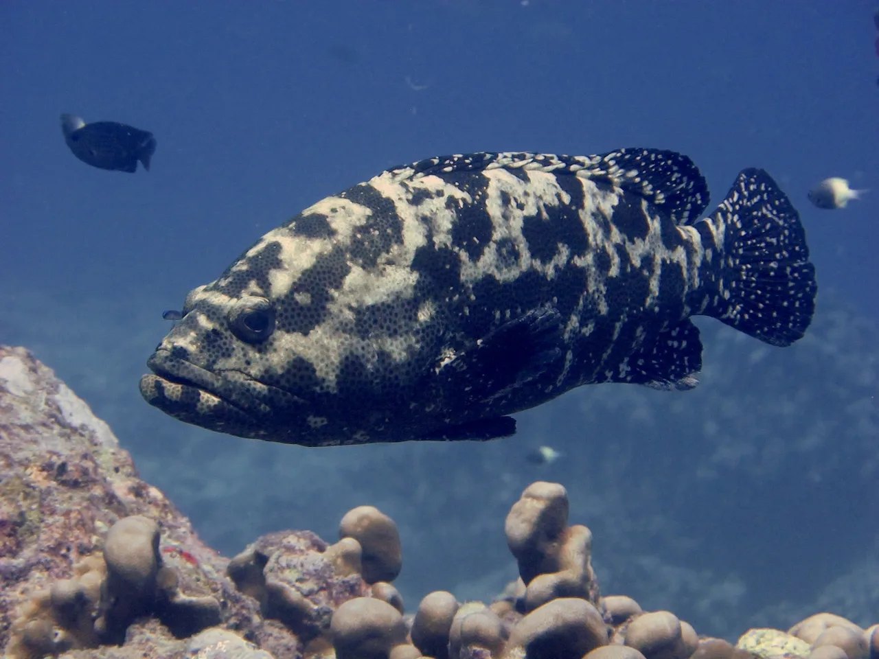
A reef-associated profile for comparing temperature, depth and habitat context around structured coastal water.
DAILY ACTIVITY
05 · SPECIES INTELLIGENCE
Move through the water column to compare the typical depth, temperature, season and habitat context of species documented in the selected region.
07 · SMART ALERTS
Set your location, fishing hours, wind, waves and minimum Bite Index. FishSignal watches the forecast and alerts you when your rules match.
06 · LOCATION INTELLIGENCE
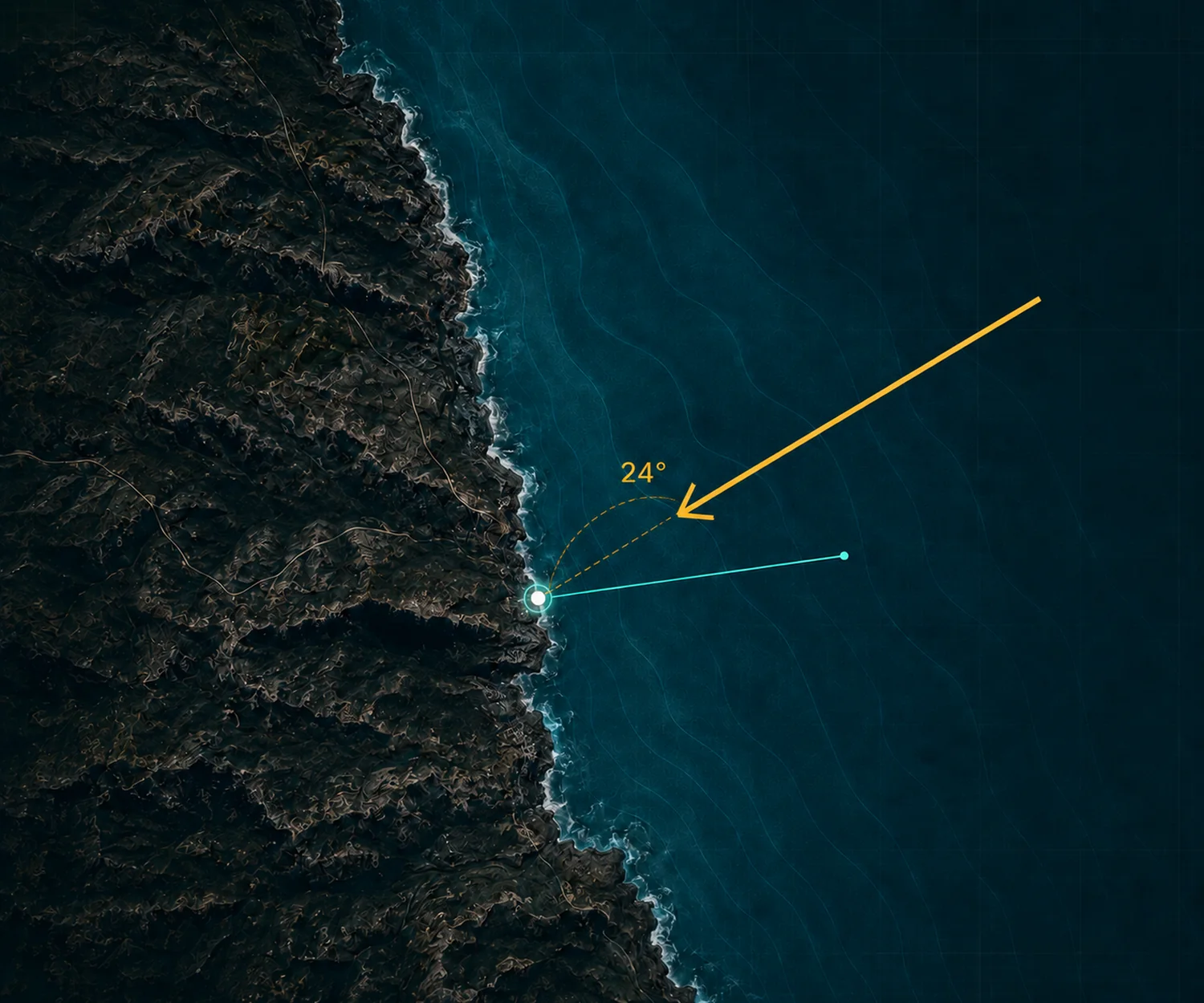
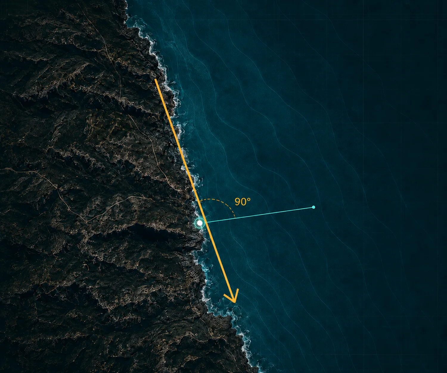
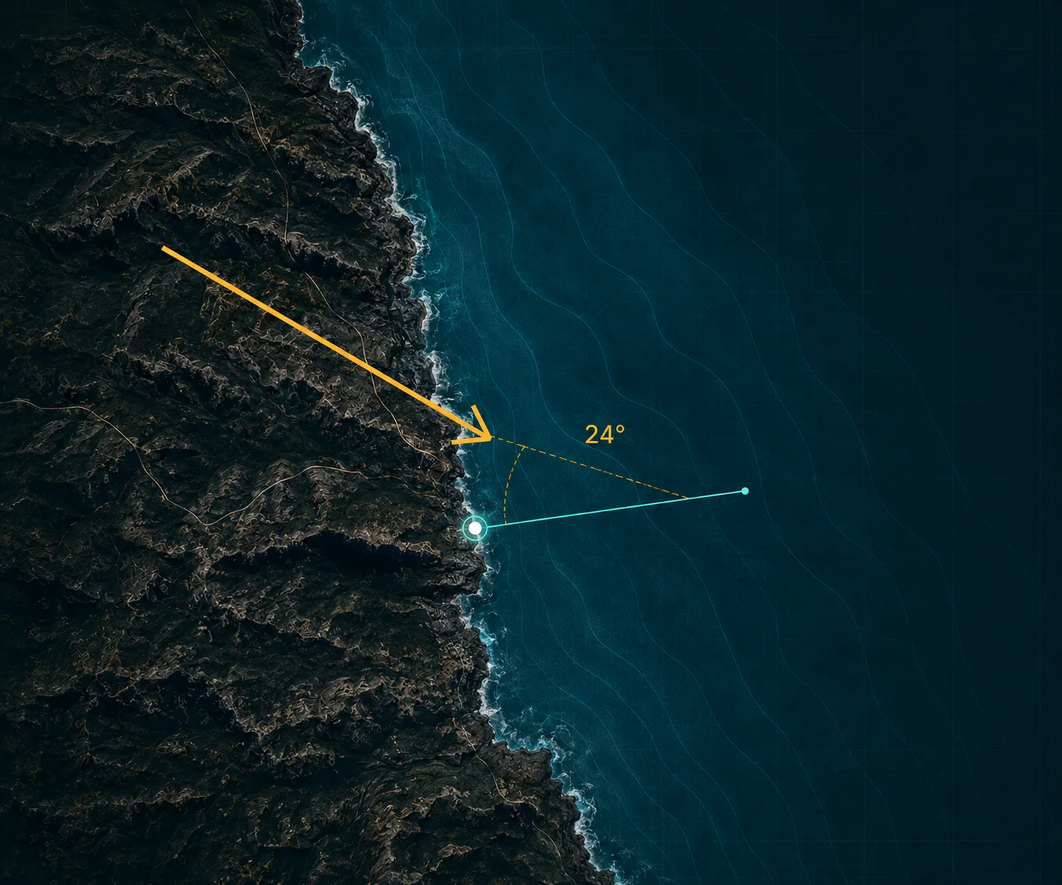
FishSignal compares forecast wind direction with the shoreline orientation at your saved spot—classifying it as onshore, cross-shore or offshore.
Wind flows from land toward the water.
i Planning context only—not a safety or catch promise.
08 · ACCESS
Use FishSignal instantly in your browser, add it to your home screen, or open it inside Telegram.
Browser
HOME SCREEN
Telegram Mini App
09 · PRICING
Get the complete FishSignal planning experience for the locations, conditions and species that matter to you.
Billed monthly. Cancel anytime.
GET FISHSIGNALFishSignal provides planning context and does not guarantee a catch.
10 · FAQ
See what FishSignal calculates, where the data comes from, and what its planning signals can—and cannot—tell you.
The Bite Index is a weather-based planning signal from 0 to 10. It combines available weather and marine conditions—such as wind, waves and pressure—into one comparable score. Use it to compare different hours and locations, not as a prediction of fish presence or a guaranteed result.
No. FishSignal helps you compare forecast conditions and plan a fishing window. Fish behaviour also depends on local habitat, food availability, season, water conditions and many factors that cannot be measured or predicted precisely. A strong signal means the selected planning conditions align—it does not guarantee a catch.
FishSignal is launching with selected coastal locations in the United States and Europe. Available forecasts, shoreline analysis and species context can vary by location. The app shows which features are available before you save or configure a location, and coverage will expand over time.
Both. Shoreline wind classification is designed specifically for shore-based spots, while forecasts, the Bite Index, species context and Smart Alerts can also help with boat-trip planning. FishSignal does not provide marine navigation, routing or safety instructions.
Species information helps you understand which fish have been documented in the selected region and compare their general habitat, depth and temperature preferences. Regional presence does not mean a fish is currently at your chosen spot. Depth and temperature ranges can overlap between species and vary by region, season and life stage. The interactive water-layer display is illustrative and does not show actual fish locations.
Choose a location and define the conditions that matter to you, such as a time window, maximum wind or wave values, wind classification and minimum Bite Index. FishSignal checks the forecast and sends an alert when the configured conditions match. A matched alert means your rules align with the forecast; it does not guarantee fishing success.
You can open FishSignal in a modern mobile browser, add it to your home screen where installation is supported, or use the Telegram Mini App. Notification availability depends on your device, browser and notification permissions.
FishSignal Premium includes the forecast explorer, Bite Index, regional species context, depth and temperature profiles, shoreline-relative wind analysis, saved locations and configurable alerts. The plan costs $8.99 USD per month and is billed monthly. You can cancel before the next renewal from your account or through the billing platform used for the subscription.
11 · YOUR NEXT WINDOW
Choose a location, compare the forecast, and create an alert for the fishing window that fits your rules.
YOUR LOCATION · YOUR RULES · ONE SIGNAL